
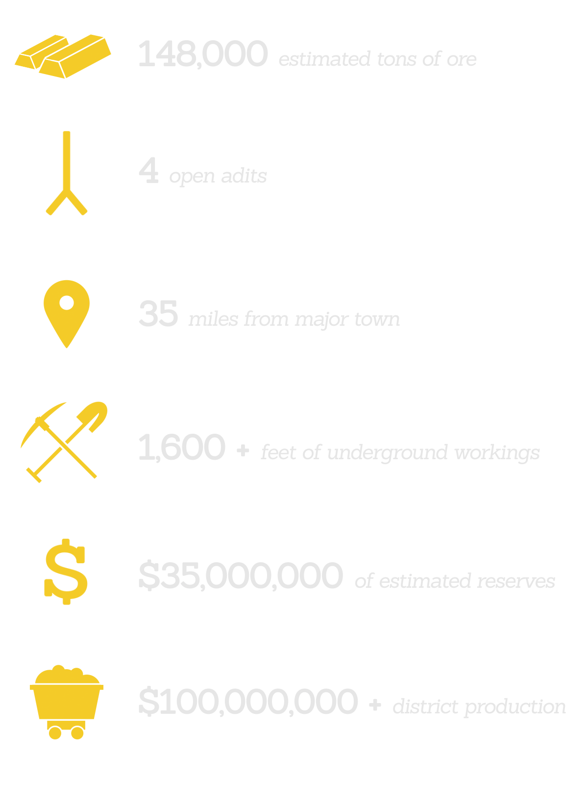
Sunset Mine Quick Facts
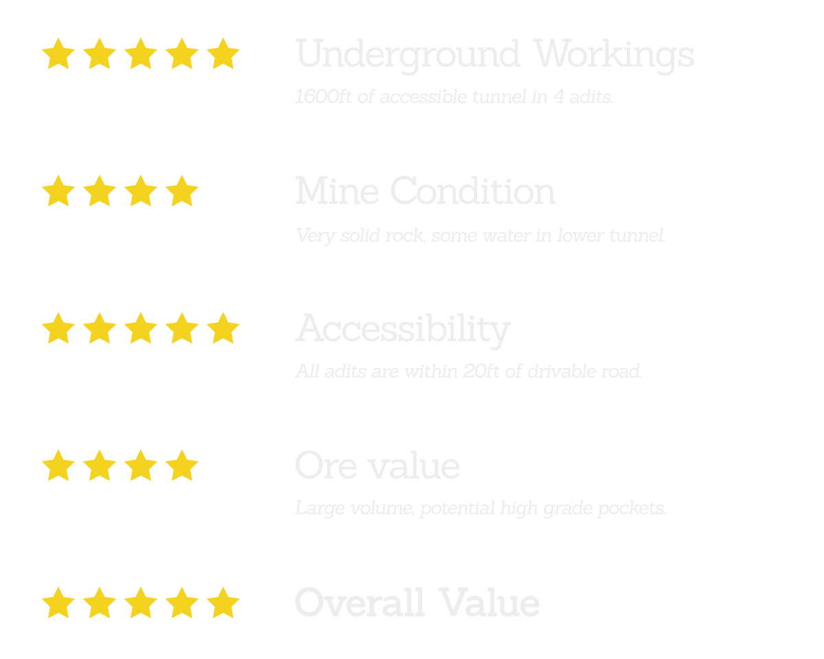
Sunset Mine Ratings
Summary of Claim
Up for sale is the Sunset Mine located in the famous Bohemia Mining District of Lane County, Oregon. The Sunset Mine is a single unpatented claim located on the south side of Noonday Ridge, 38 miles from the town of Cottage Grove, OR. Just a few miles from the claim are some of Oregon’s most famous and productive gold mines such as the Champion, Musick, and Noonday Mines.
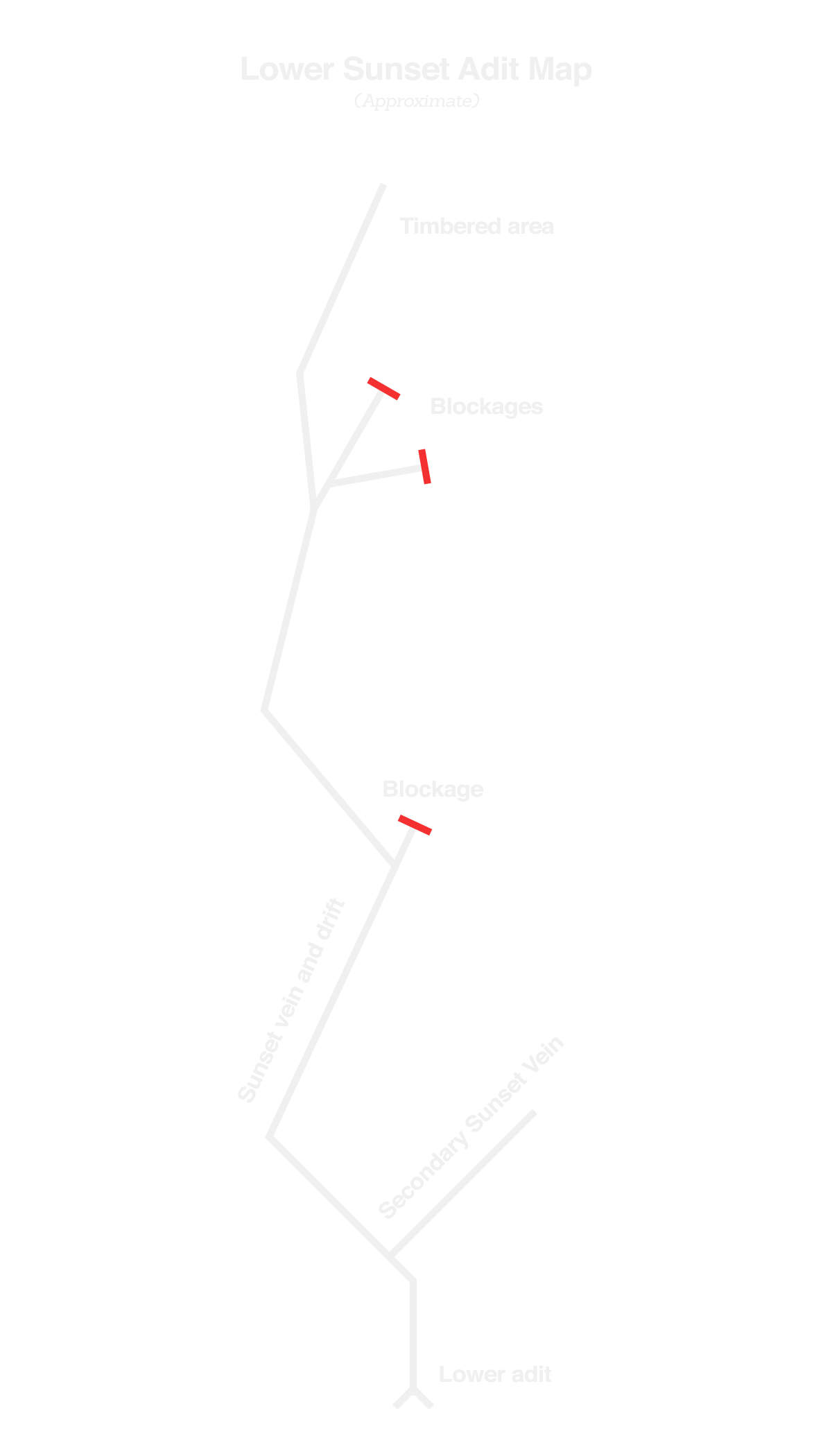
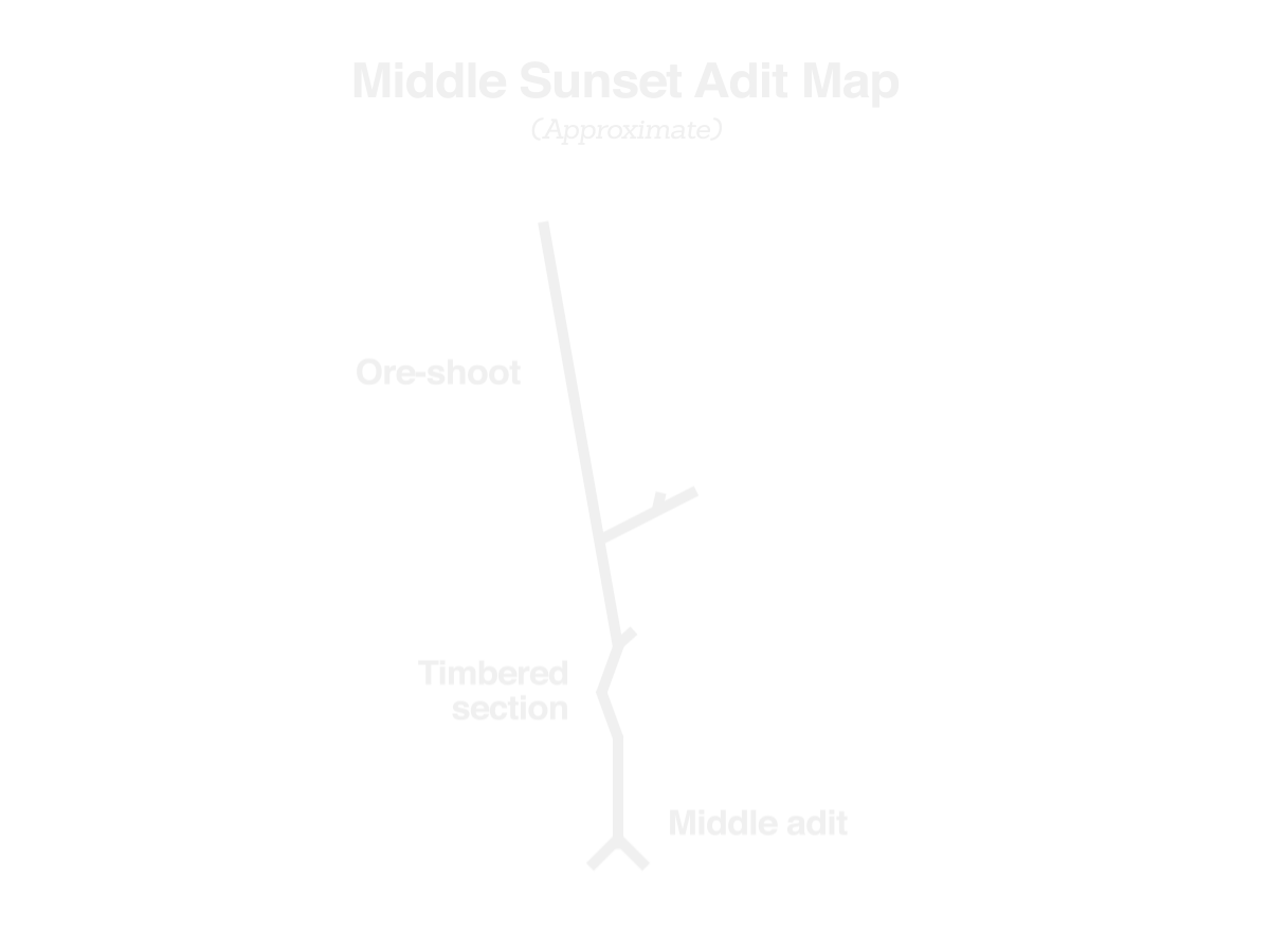
The Sunset Mine produced gold, silver, lead, zinc & copper. On the claim are four known adits, driven into Noonday ridge, which explore two primary veins. The lower and middle adits are the primary working tunnels, the upper adit is a short prospect. The lower adit crosscuts the vein for several hundred feet and also intersects a secondary vein. The adit then follows the vein for nearly 1,000ft. The lower tunnel contains over 1,200ft of underground workings. The middle adit is a drift along the same primary vein about 100ft higher in elevation. This adit is drifted for approximately 300ft along the vein. The upper adit is only 10ft long and is mostly caved. The fourth "Bonus" adit was driven along a separate vein and is 100ft long. The mine was likely discovered in the late 1800’s or early 1900’s. Unfortunately, much of the mine’s history remains a mystery.
In total, this claim contains over 1,600ft of underground workings making it one of the most extensive mines offered for sale on Ebay. While the assays aren’t spectacular, one may wonder why so much underground development was undertaken...The answer is most likely the existence of rich pockets or ore-shoots containing tremendous amounts of gold and silver. Though our team could not locate any of these especially rich pockets, they are most certainly present somewhere in the mine.
| Feature | Description |
|---|---|
| Adits: | 4 open adits |
| Cuts and Pits: | Scattered prospect pits |
| Artifacts: | Ore cart rails, wheelbarrow, metal debris. |
| Structures: | None. |
| Resources: | Timber, water, existing roads |
| Opening | Drifts | Crosscuts | Total |
|---|---|---|---|
| Lower Adit | 900ft | 300ft | 1,200ft |
| Middle Adit | 300ft | 50ft | 350ft |
| Upper Adit | 10ft | 0ft | 10ft |
| Bonus Adit | 100ft | 0ft | 100ft |
| Total Underground Workings | 1,310ft | 350ft | 1,660ft |
What is Being Sold
- 13.8 acre Sunset Mine unpatented mining claim ORMC 174221.
- GPS coordinates to all adits, corner posts and other places of interest.
- Most recent assay results done by ALS Minerals.
History
Little is known about the history of the Sunset Mine. The earliest mention of the mine we were able to locate was from a newspaper article dated September 14, 1895 which can be seen below.
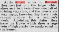
Considerable development was apparently taking place during this time and likely into the the early 1900’s. The next phase of serious activity occurred during the 1980’s, when a large mining company leased this claim and several others surrounding it. The company spent two years conducting extensive surface trenching with bulldozers and geologic mapping before they went bankrupt. The claim has been under the radar ever since.
The development on the Sunset claim was tremendous. Containing over 1,600ft underground workings, this mine was not simply a prospect, but a mine geared toward industrial scale production. Tens of thousands of dollars were invested into driving the Sunset adits, thus it is safe to assume that such an investment would have been made for a reason.
Geology
The Geology at the Sunset mine is very similar to what is found at other mining properties in the Bohemia Mining District. The primary vein explored at the mine is known as the “Cape Horn Vein”. Unlike many veins in the Bohemia Mining District which are narrow and short lived along their strikes and dips, the Cape Horn is wide and persistent, being traced for over 4,000 feet on the surface through a vertical distance of 1,500 feet. The average width of the vein appears to be around 4 feet, with some portions up to 8-10ft in width. Common sulfides include pyrite, chalcopyrite, sphalerite, and galena, all of which are more or less common throughout the entirety of the vein. Certain portions of the vein have been heavily mineralized with these sulfides and are just waiting to be mined.
As part of our evaluation of the mine, we had five samples sent in to get assayed. To our surprise, none of the samples showed any significant levels of gold. If the vein was only 1 foot wide and traced for 200 feet along strike, these results would have made us walk away from this mine. However, that is certainly not the case. The Sunset Mine is sitting on top of a tremendous vein. The five grab samples we took are in no way a definitive representation of the values of the vein as a whole.
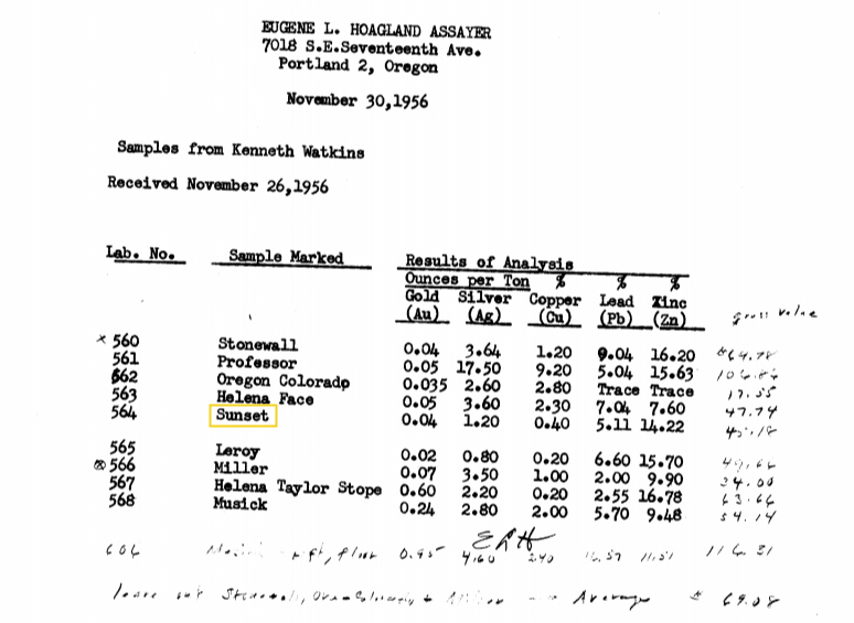
Many of the other prolific veins in the Bohemia Mining District display similar gold mineralization, where certain portions of the vein contain low values of gold with high grade pockets being found off and on. It cannot be said for certain if any such pockets exist at the Sunset Mine, but the sheer volume of vein material waiting to be sampled certainly warrants further investigation into this possibility. Below are assay results for several Bohemia mines, the Sunset included. There are extreme similarities between the Sunset and some of the other mines in Bohemia. For example, the Helena Mine assayed almost identically to the Sunset. Despite showing such low values, the Helena Mine was actually very productive and is now one of the most famous mines in the district.
| Sample No | Sample Location | Gold (oz/ton) | Silver (oz/ton) | Copper (%) | Lead (%) | Zinc (%) |
|---|---|---|---|---|---|---|
| Sample 1 | Lower Adit | Trace | 2.21 oz/ton | 0.713% | 0.988% | 27.70% |
| Sample 2 | Middle Adit | Trace | 0.448 oz/ton | 0.235% | 2.360% | 3.740% |
| Sample 3 | Middle Adit | Trace | 0.320 oz/ton | - | - | - |
| Sample 4 | Middle Adit | Trace | 0.576 oz/ton | - | - | - |
| Sample 5 | Vein surface | Trace | 0.992 oz/ton | - | - | - |
Below are the raw values that were sent to us directly from ALS Minerals. These values are in PPM (not oz/ton) but are equivilent to the values given above.

Estimated Total Reserves
Using some very conservative dimensions of the primary vein, the average assay values and current mineral prices, we were able to calculate the estimated value of the Sunset vein. Note, the vein has been traced over 1,000 ft vertically. The total Sunset vein tonnage was estimated to be 148,000 tons.
| Vein Length | Vein Width | Vein Height | Total Est. Vein Tonnage |
|---|---|---|---|
| 500ft | 4ft | 1,000ft | 148,000 tons |
Using the 148,000 tons of ore material, we used our assay values to determine the total estimated value of the Sunset vein. Since we did not discover any high grade pockets of gold ore, we excluded gold from the calculation.
| Metal | Concentration | Tonnage | Value (2017 Prices) |
|---|---|---|---|
| Ag | 2 oz/ton | 9.25 tons | $5,000,000 |
| Cu | 0.5 % | 740 tons | $4,000,000 |
| Pb | 1.5 % | 2,220 tons | $5,000,000 |
| Zn | 5.0 % | 7,400 tons | $21,000,000 |
| Au | Varies | - | - |
| VEIN TOTAL | - | 148,000 tons | $35,000,000 |
Comparing to Other Mines in Bohemia
Below are data from some of Bohemia’s most successful mines compared to the Sunset Mine. It’s clear from this comparison that the Sunset has huge potential to be a masssive producer. The Champion Mine (listed below) was the largest and most productive mine in the Bohemia district and is just a few miles from the Sunset Mine.
| Mine Name | Location | Underground Workings | Total Production (adj. 2017) |
|---|---|---|---|
| Sunset Mine | Bohemia Mining District | 1,600ft | Unknown |
| Champion Mine | Bohemia Mining District | 30,000ft | $41,000,000 |
| Noonday Mine | Bohemia Mining District | 5,000ft | $2,200,000 |
| Helena Mine | Bohemia Mining District | 3,000ft | $2,000,000 | Musick Mine | Bohemia Mining District | 4,300ft | $9,300,000 |
Video of the Sunset Mine
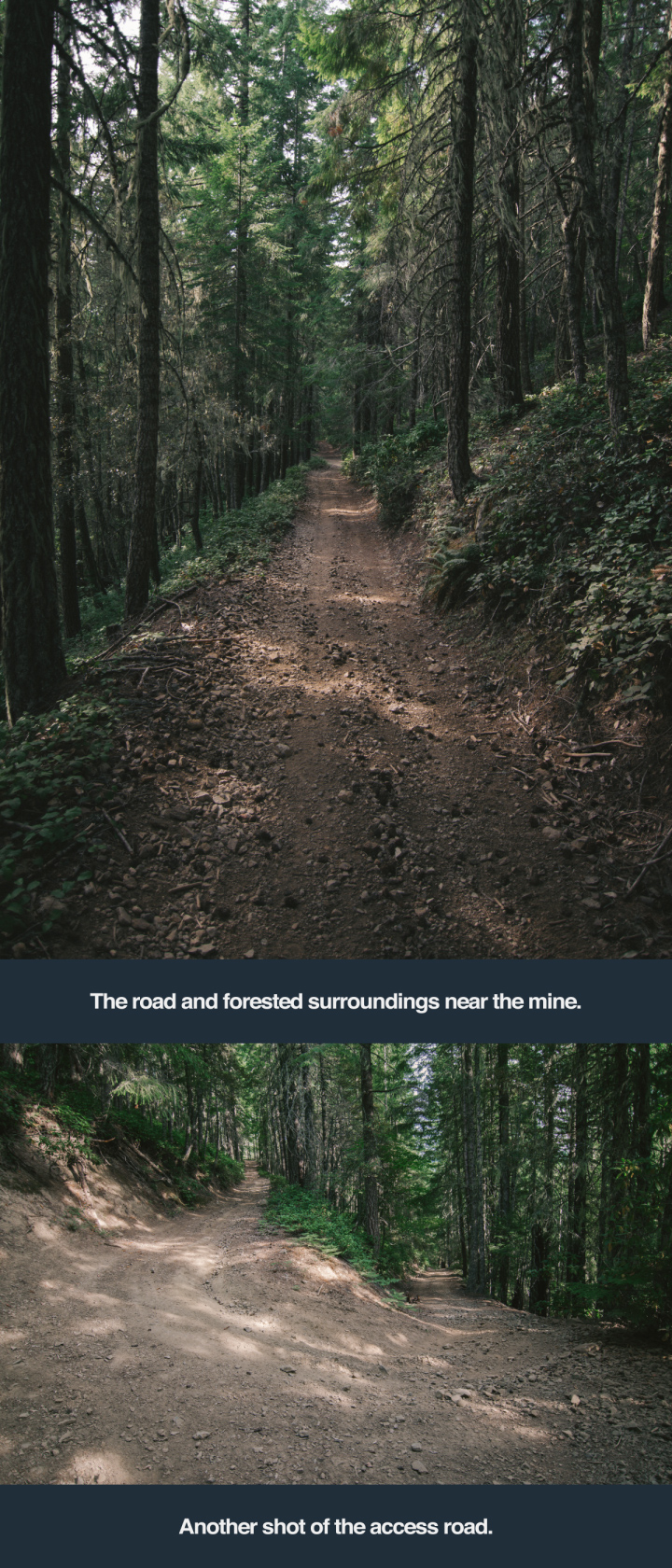
Pictures of the claim


Accessibility
The mine can be reached by driving 35 miles from Cottage Grove, OR. Both lower and middle mine adits are directly alongside the gravel road. A 2WD low clearance vehicle can be driven to within ⅓ mile of the lower adit. A mid-sized 4WD truck or ATV is recommended to complete the drive to the mines as the final access road is narrow and steep, but still in very good condition.
Underground Workings Maps
For a better understanding of the Sunset Mine's underground workings, we have provided maps for both the upper and lower adits. These maps are not to scale and are approximations.
Map of Claim
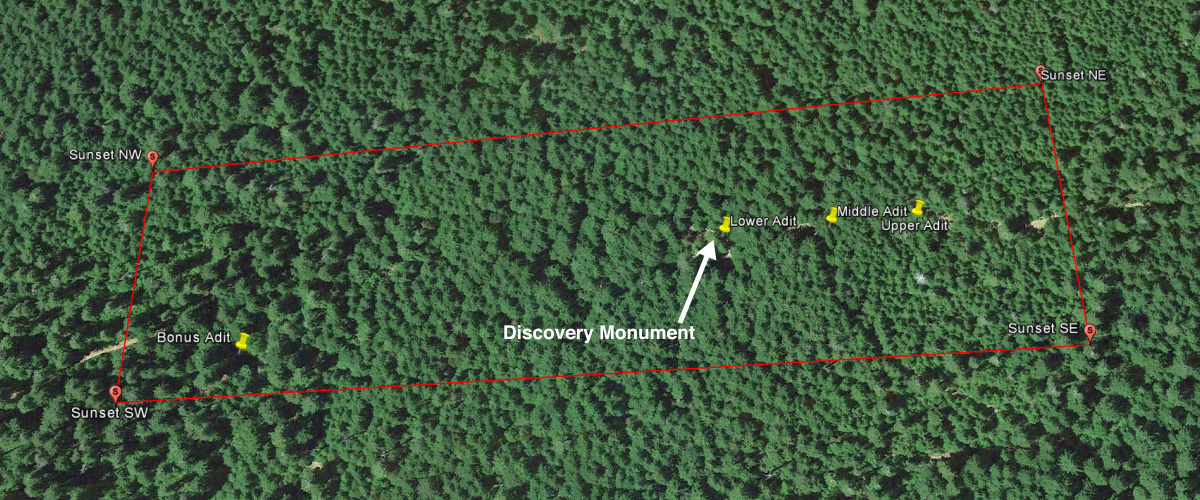
Below is a map of the claim showing the important features onsite. The buyer will recieve more detailed location information including coordinates and directions once the the auction has ended.
Corner Posts
The Sunset Mine is ready to go! All four corner posts and the discovery monument have been installed on the claim. Coordinates to these post and the discovery marker will be given to the purchaser.
About Us
Bonanza Gold Claims is the Ebay user name for two mining enthusiasts, Graham Spencer and Joe Ghiorso. Graham is an undergraduate Mechanical Engineering student at Oregon State University and has worked as an engineer in both the mining and automotive industries. He has been associated with the mining community for several years and has spent hundreds of hours underground in hardrock mines. Joe Ghiorso is an undergraduate Geology student at Oregon State University and has done extensive mineral exploration throughout the state of Oregon. He currently owns and operates several small scale hardrock mines in the Oregon Cascades.
Contact Information
If you have any questions, concerns, or comments please do not hesitate to contact us. If you would like a tour of the property or would like to take samples prior to bidding, please contact us and we will schedule a time.
BonanzaClaims@gmail.com
Purchase and Sale Agreement
Payment will be made pursuant to terms substantially in the form of the attached Purchase and Sale Agreement through an escrow for the protection of each party.
PURCHASE AND SALE AGREEMENT (LINK)
Terms and Conditions Upon Successful Bid
Notice of the winning bid will be confirmed in writing to the purchaser. Purchaser will be provided and be required to sign, a Purchase and Sale Agreement substantially in the form as the attached Agreement. The transaction will be closed through an escrow as set forth in the Agreement. Any questions regarding the buyer’s legal duties and rights under the Purchase and Sale Agreement should be directed to independent legal counsel for the purchaser.
Disclaimer
This sale is final. The buyer stipulates that they enter into this purchase in sole reliance upon their own judgement and upon their own personal investigation of the claim, and not upon any representation by the seller or any person whatsoever, regarding, but not limited to; the claim; the character of the claim; maintaining the claim’s status and mineral rights; quantity of minerals; value of minerals; access to claim; mining and milling methods; safety of any mining activity of the claim; and the income that may be derived therefrom.
Access to this claim, by a prospective purchaser, for the purpose of conducting an independent investigation and private due diligence, including but not limited to mineral inspection, may be obtained upon reasonable request to seller. No other entry is permitted.
This claim is subject to and regulated by multiple government entities including but not limited to; US Forest Service, BLM, Linn County, Oregon, and the State of Oregon. Following purchase, it is the buyer’s obligation to operate and maintain the claim in compliance with the various county, state and federal agencies, regulations and laws.